
Related Stories
Interactions Stories
Don’t Wing the Future
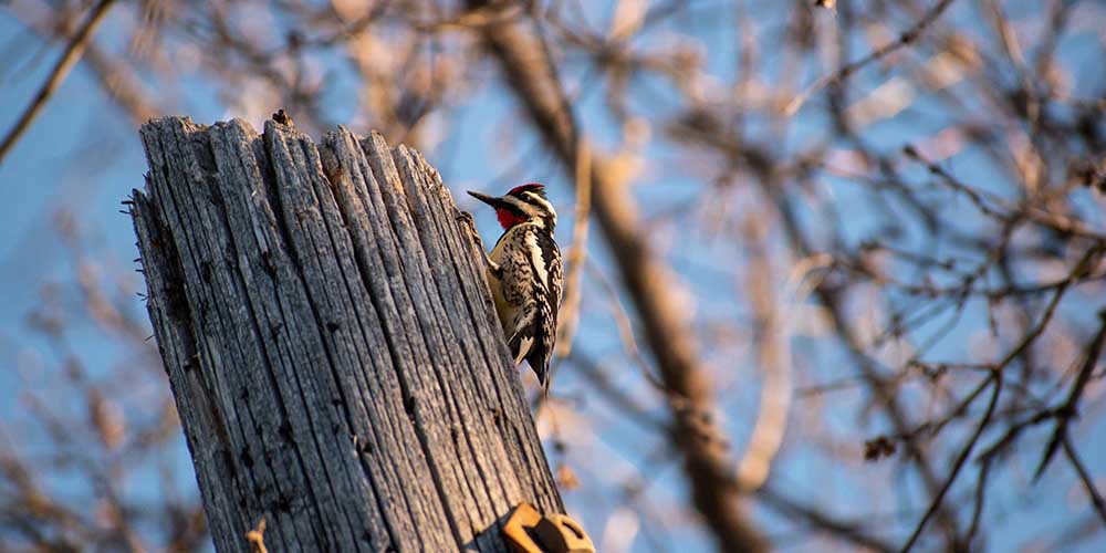
Power companies across the nation spend millions of dollars each year repairing and replacing utility poles damaged by woodpeckers. FWRC researchers, led by Dr. Scott Rush, a wildlife, fisheries and aquaculture associate professor, developed a predictive map of where such damages will likely occur, giving power companies a proactive and cheaper way to head of damage before the pecking even begins. The Tennessee Valley Authority keeps the lights on in a seven-state region, serving portions of Tennessee, Mississippi, Alabama, Georgia, Kentucky, North Carolina, and Virginia. Since TVA supplies electricity, if a pole snaps due to woodpecker damage there’s a potential for bodily harm, fire, or even local impact to the grid. Rush designed a unique map that gives TVA more information as to the locations and trends of woodpecker damage.
Rush’s team analyzed various databases for woodpecker population statistics, measured different environmental factors, and gathered in-person data on numerous damaged utility poles. The data was then cross-referenced with information given by TVA of utility pole damage and replacement to establish trends among the locations and offer reasonable predictions as to what locations the woodpeckers might damage next. This work was funded by the Tennessee Valley Authority, Alabama Ornithological Society, and the United States Geological Survey.
2020
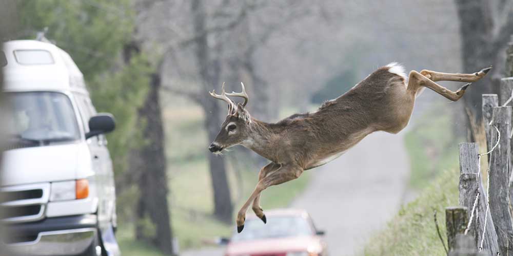
Understanding Deer's Flight Response to Avoid Vehicle Collision
In the U.S., deer/vehicle collisions cause 1.5 million motor vehicle accidents each year, resulting in 200 fatalities and over a billion dollars in property damage. That's why an FWRC scientist, with lead collaborators from participating agencies, sought to better understand how deer respond to approaching vehicles before a collision occurs. Dr. Ray Iglay, assistant professor in the Department of Wildlife, Fisheries and Aquaculture and FWRC researcher, was part of a team that evaluated deer responses to approaching vehicles. The aim of the team was ultimately to decide how the deer responded to different threats, whether they would go across the road or away from the road. The team conducted an opportunistic experiment protocol, recording observations of deer during a six-month period on two lane roads with maximum speeds of 40 miles per hour.
The researchers studied flight initiation distance (FID) or the distance from an approaching predator at which the prey flees. The team recorded 328 vehicle approaches toward groups of an average of two deer. While the team found that proximity to the road influenced FID, deer didn't demonstrate spatial or temporal safety thresholds and FID wasn't impacted by either oncoming vehicle speed or environmental conditions. The team also found that road crossing was influenced by group size and proximity to the road. Collaborators include Dr. Morgan Pfeiffer, Dr. Bradley Blackwell, and Mr. Thomas Seamans, U.S. Department of Agriculture, Animal and Plant Health Inspection Service (APHIS); Dr. Travis Devault, Savannah River Ecology Laboratory, University of Georgia; Wildlife Services, National Wildlife Research Center, and the Ohio Field Station.
This research is funded by FWRC and U.S.D.A. Wildlife Services National Wildlife Research Center.
2022
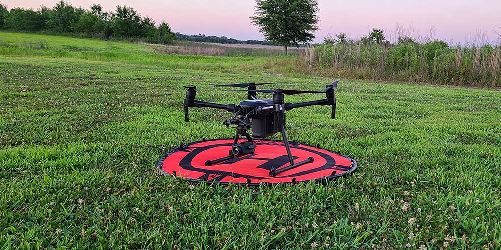
FWRC Scientists Look to Drones to Identify Potential Flight Disruptions
Wildlife residing near airports can pose threats to aircraft and themselves. Dr. Ray Iglay, principal investigator and assistant professor of wildlife ecology, and his team of FWRC scientists are using small Unmanned Aircraft Systems (sUAS), commonly known as drones, to do the wildlife surveillance work at airports traditionally done by biologists. Iglay said that getting accurate counts of wildlife is difficult because they can be hidden or camouflaged. Iglay and his team worked on testing the drones at local airports and on designing software that would detect the animals, identifying both their location within the landscape and their species. This effort is part of a larger research collaboration among MSU, the Ohio Field Station of USDA/APHIS Wildlife Services National Wildlife Research Center, and the Federal Aviation Administration, or FAA.
Iglay said that the project aimed to provide a system to the FAA that will allow them to monitor wildlife using sUAS and inform mitigation efforts in aircraft-wildlife incidents.